POP
Plateforme ouverte du patrimoine
Carte
Sujet de la photographie
Localisation
Localisation
France, Centre-Val de Loire, Cher, Saint-Priest-la-Marche, Lande (la)
Code INSEE de la commune
18232
Identification
Objet
Carte
Titre courant de l'œuvre
Carte
Légende
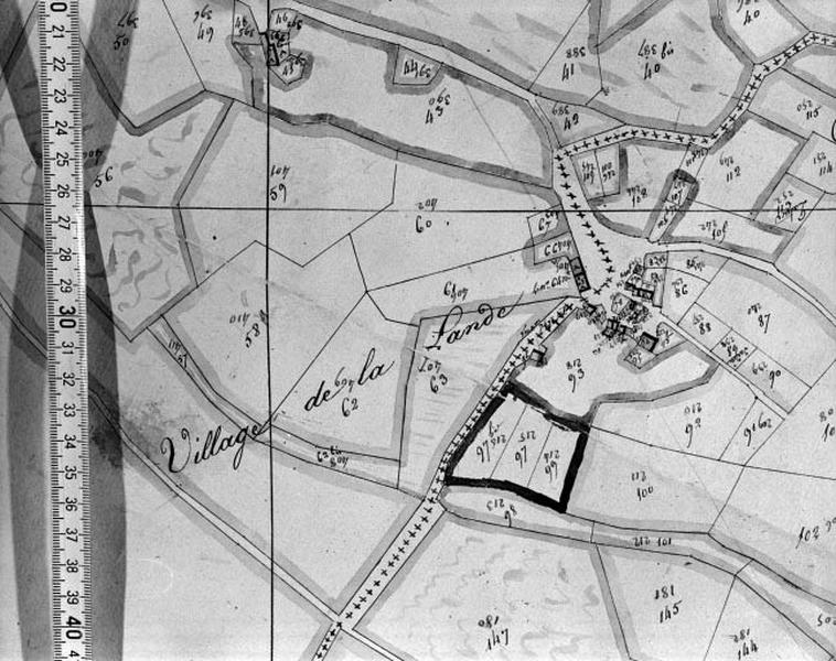
Hameau de La Lande : plan cadastral 1810, sans échelle.
Mots-clés
Plan ; carte
Références des documents reproduits
Lieu de conservation du document reproduit ou de l'objet
Archives départementales du Cher, Bourges
Cote de conservation du document reproduit
Plan n°747, section B.
Auteur
Photographe ou dessinateur
Description de la photographie
Éléments d’identification
Catégorie de phototype
Phototype argentique
Numéro du phototype
92180539X
Précisions sur la conservation de l'original
Plan cadastral.
Droits diffusion
Reproduction soumise à autorisation du titulaire des droits d'exploitation
Description technique du phototype
Format du négatif
X
Datation et événements liés à l’image
Date de prise de vue
1992