POP

Plateforme ouverte du patrimoine

Mairie, rue d'Auray (Baud)

Désignation

Dénomination de l'édifice

Mairie

Titre courant

Mairie, rue d'Auray (Baud)

Localisation

Localisation

Bretagne ; Morbihan (56) ; Baud ; Auray (rue d') ; Madeleine (rue de la)

Aire d'étude pour le domaine Inventaire

Baud

Canton

Baud

Adresse de l'édifice

Auray (rue d') ; Madeleine (rue de la)

Références cadastrales

2000 AH 498

Milieu d'implantation pour le domaine Inventaire

En ville

Historique

Siècle de la campagne principale de construction

4e quart 19e siècle (détruit) ; 2e quart 20e siècle

Année(s) de(s) campagne(s) de construction

1949

Commentaires concernant la datation

Porte la date

Commentaires concernant l'attribution de l'édifice

Signature ; signature

Description historique

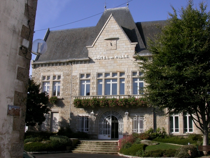
"La mairie est construite en 1949, date portée, sur des plans d'Edmond Gemain père et fils par l'entreprise générale Massardier de Pontivy. Elle est construite sur l'emplacement de l'ancienne mairie érigée à la fin du 19e siècle.Dans l'entrée est apposée une plaque de marbre avec l'inscription : "Cet hôtel de ville a été inauguré le 9 novembre 1952 par Monsieur Philippon préfet du Morbihan, assisté de Monsieur Martin. M. maire de Baud et en présence de Mr Edmond Gemain père et fils, architectes et des entrepreneurs Bergamasco, Cerabati, Guillaume, Jean Le Lain, Martineau, Massardier, Roze. Entreprise Massardier à Pontivy". La porte d'entrée en fer forgé porte une plaque sur laquelle est mentionnée le nom du ferronnier, Le Roux à Pontivy."

Description

Matériaux du gros-œuvre

Granite ; moellon ; pierre de taille

Matériaux de la couverture

Ardoise

Typologie de plan

Plan symétrique en U

Description de l'élévation intérieure

1 étage carré

Partie d'élévation extérieure

Élévation ordonnancée

Typologie de couverture

Toit à longs pans ; pignon découvert ; pignon couvert ; noue

Emplacement, forme et structure de l’escalier

Escalier dans-oeuvre : escalier tournant à retours avec jour, en maçonnerie

Commentaire descriptif de l'édifice

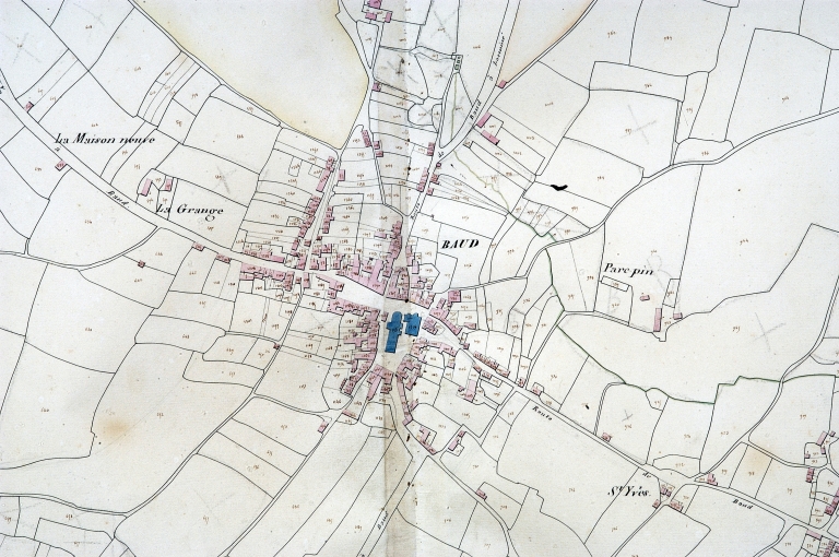
L'ancienne mairie est un édifice enduit aspecté au nord, couvert d'un toit à croupes. Il possède deux étage carrés, une élévation ordonnancée à 5 travées avec travée centrale en ressaut couronnée d'un fronton triangulaire.La nouvelle mairie est édifiée en retrait de la rue. Aspectée à l'est, elle présente un plan en U, avec ailes de retour sur l'arrière. La partie centrale est coiffée d'un toit en pavillon. L'escalier intérieur en béton est à une révolution avec jour central et rampe en fer forgé.

Statut juridique

Statut juridique du propriétaire

Propriété publique

Références documentaires

Date de l'enquête ou du dernier récolement

2002

Date de rédaction de la notice

2005

Noms des rédacteurs de la notice et du dossier

Tanguy Judith ; Toscer Catherine

Typologie du dossier

Sous-dossier

Adresse du dossier Inventaire

Région Bretagne - Service de l'Inventaire du Patrimoine Culturel - 283 avenue du général Patton - CS 21101 - 35711 Rennes Cedex 7 - 02.22.93.98.35

1/3
Mairie, élévation antérieure est ; Elévation antérieure est
(c) Inventaire général, ADAGP
Voir la notice image
Plan cadastral 1829, section AH (AD Morbihan, série 3P) ; Plan cadastral 1829, section AH (AD Morbihan, série 3P) ; Plan cadastral 1829, section AH (AD Morbihan, 3P) ; Plan cadastral 1828. Section (AD Morbihan, 3P) ; Plan cadastral 1829, section AH (AD Morbihan, série 3P) ; Plan cadastral 1829, section AH (AD Morbihan, série 3P) ; Plan cadastral 1829, section AH (AD Morbihan, série 3P) ; Extrait du cadastre ancien de 1829, section AH (A.D. Morbihan, série 3P) ; Plan cadastral 1829, section AH (AD Morbihan, série 3P) ; Plan cadastral 1829, section AH (AD Morbihan, série 3P) ; Plan cadastral 1829, section AH (AD Morbihan, série 3P) ; Plan cadastral 1829, section AH (AD Morbihan, série 3P) ; Plan cadastral 1829, section AH (AD Morbihan, série 3P) ; Plan cadastral 1829, section AH (A.D. Morbihan, série 3P) ; Plan cadastral 1829, section AH (AD Morbihan, série 3P) ; Plan cadastral 1829, section AH (AD Morbihan, série 3P) ; Plan cadastral 1829, section AH (AD Morbihan, série 3P) ; Plan cadastral 1829, section AH (AD Morbihan, série 3P) ; Plan cadastral 1829, section AH (AD Morbihan, série 3P) ; Plan cadastral 1828. Section (AD Morbihan, 3P) ; Plan cadastral 1829, section AH (AD Morbihan, série 3P) ; Plan cadastral 1829, section AH (AD Morbihan, série 3P) ; Plan cadastral 1829, section AH (AD Morbihan, série 3P) ; Le bourg, extrait du plan cadastral de 1829, section AH (A.D. 56, série 3P)
(c) Inventaire général, ADAGP
Voir la notice image
Vue vers le sud. Carte postale ancienne, Ed. Le Pallec à Baud (AD Morbihan, 9 Fi) ; Ancienne mairie. Carte postale ancienne, Ed. Le Pallec à Baud (AD Morbihan, 9 Fi)
(c) Inventaire général, ADAGP
Voir la notice image