POP
Plateforme ouverte du patrimoine
Carte
Sujet de la photographie
Localisation
Localisation
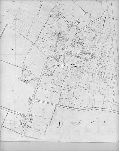
France, Centre-Val de Loire, Indre, Pouligny-Saint-Pierre, Champ-Cornu
Code INSEE de la commune
36165
Identification
Objet
Carte
Titre courant de l'œuvre
Carte
Légende
Plan en 1819 d'après cadastre au 1/5000e, section L2.
Mots-clés
Carte
Références des documents reproduits
Lieu de conservation du document reproduit ou de l'objet
Service du cadastre, Le Blanc
Auteur
Photographe ou dessinateur
Description de la photographie
Éléments d’identification
Catégorie de phototype
Phototype argentique
Numéro du phototype
93360171X
Droits diffusion
Reproduction soumise à autorisation du titulaire des droits d'exploitation
Description technique du phototype
Format du négatif
X
Datation et événements liés à l’image
Date de prise de vue
1993